surveying Sourcing Overview

Accuracy:
2 mm1 cm2"0.1 Degree
Weight:
350 g575 g730 g780 g800 g820 g970 g1.2 kg1.3 kg3.8 kg
Battery Capacity:
3000 mAh x 23400 mAh x 26500 mAh6800 mAh6900 mAhSupports 15 HoursLong Working Hours
Channels:
22033657666080096514081760
GNSS Systems Supported:
GPSGlonassGalileoBeidouQZSSSBAS
  • Accuracy and Measurement Precision Overlooking the impact of accuracy levels like 2 mm versus 2" can lead to costly rework or unreliable data in surveying projects; prioritize devices that meet your specific precision requirements to avoid these pitfalls.

  • Battery Capacity and Operational Time Negotiate for surveying equipment with higher battery capacities such as 6800 mAh or those explicitly supporting 15 hours of continuous use to ensure uninterrupted field operations and reduce downtime.

  • GNSS System Compatibility In practice, most advanced surveying instruments support multiple GNSS systems including GPS, Glonass, Galileo, Beidou, QZSS, and SBAS, enhancing positioning reliability and coverage in diverse geographic regions.

  • Channel Count and Device Weight Trade-off The trade-off between a higher number of channels (e.g., 1408 or 1760) and the device weight (ranging from 350 g to 3.8 kg) depends on your field mobility needs; heavier units may offer more channels but could impede ease of transport and handling.

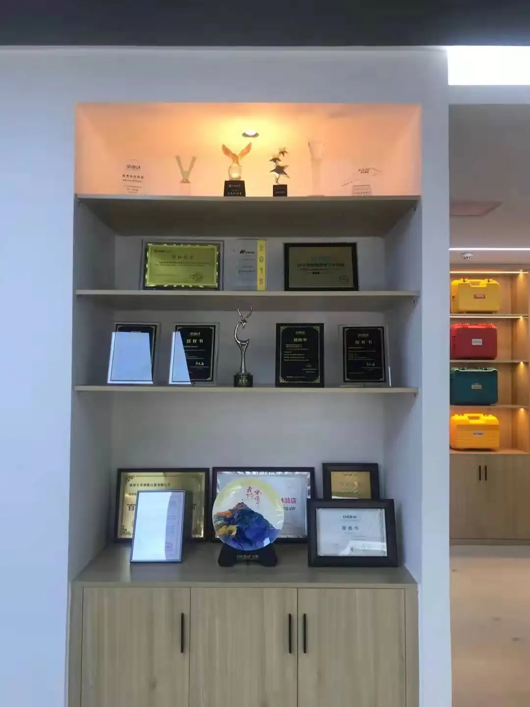
Beijing Huace Navigation Technology Co., Ltd.ali-icon
Lead Time 3 DaysLow MOQ 1 piecesAverage Response ≤ 6hEscrow Service5 Reviews
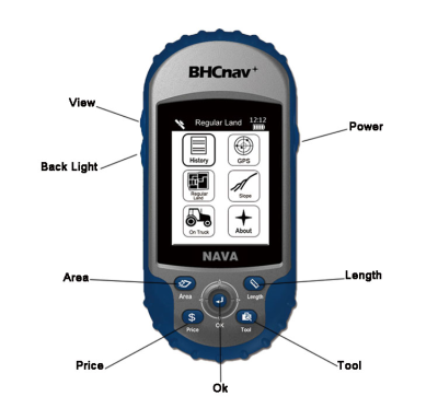
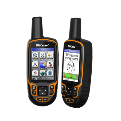
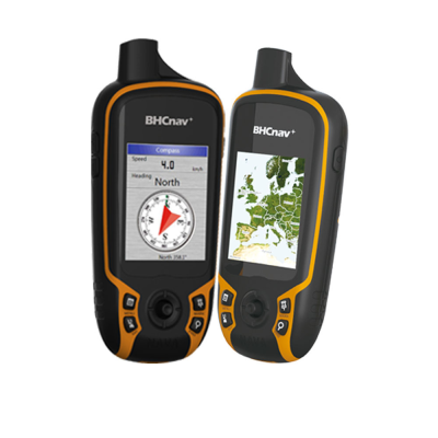
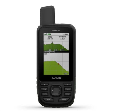
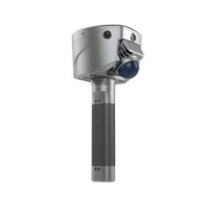
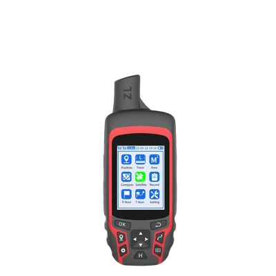
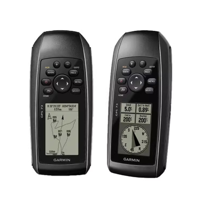
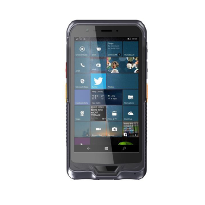
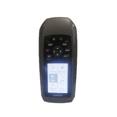
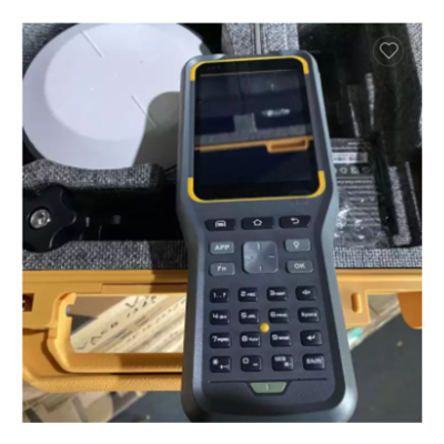
Main Products:Handheld GPS,Area Calculation GPS,Laser Range finder,Tablet PC,GIS data collector
Address:No. 18,Zhongguancun East Road,Haidian District Beijing China
Export Year:2010-12-21
Civil Engineering Survey GPS Machine Industrial Measure Handheld GPS
Topography Compass Surveying Instruments Similar to Garmi GPSMAP 78 Handheld GPS
High Precision Fish Finder Handheld GPS Navigation for Coordinate Location
Shanghai Apekstool Optoelectronic Technology Co., Ltd.ali-icon
Lead Time 3 DaysAverage Response ≤ 6hEscrow Service56 Reviews
Main Products:GNSS RTK GPS Receiver,Total station,Electronic theodolite,Auto level,Laser level
Address:Hongxiang North Road,Lingang New Zone,China (shanghai) Pilot Free Trade Zone Shanghai China
Export Year:2021-08-03
Outdoor Water-proof Multi Satellite Handheld With Sensors Gps Map 66S for Adventure Hiking Camping  Surveying Navigation Gps
Outdoor Water-proof Multi Satellite Handheld With Sensors Gps Map 66S for Adventure Hiking Camping Surveying Navigation Gps
High Accuracy Volume Calculation AR Stakeout Image Measurement Land Survey  Rtk Hi-target Slam V700s
High Accuracy Volume Calculation AR Stakeout Image Measurement Land Survey Rtk Hi-target Slam V700s
Multisatellite Handheld With Sensors Gps Map A6 Handheld Gps Survey Mini Navigation
Sanming Sky Beidou Surveying And Mapping Equipment Co., Ltd.ali-icon
Lead Time 14 DaysAverage Response ≤ 6hEscrow Service81 Reviews
Main Products:Total Station, GPS RTK, Theodolite, UAV, Surveying Accessories
Address:No. 105,Building 10,No. 280 Xinshi Middle Road Sanming Fujian China
Export Year:2019-02-20
South Chuangxiang Southern Surveying New Intelligent Interactive RTK/GPS Surveying Instrument Engineering Surveying
V2 RTKV2 Visual Inertial Version Measuring Instrument Engineering Surveying Fixed-point GPS with OEM Customized Support
South Cloud Sail RTK Inertial GPS Surveying Instrument Centimeter Level High-precision Engineering Coordinate Layout
CHCNAV GPS RTK Drone Measuring Instrument X7 GPS Inertial Navigation Engineering Surveying Instrument High-precision Navigation
Shanghai Cefu Optoelectronics Technology Co., Ltd.mic-icon
Lead Time 15 DaysAverage Response ≤ 6hEscrow Service4 Reviews
Main Products:Gnss Receiver, Total Station, Rotary Laser Level, Unmanned Boat, Gnss Rtk, Surveying Instrument, GPS Rtk, GPS Receiver, Handheld GPS, Auto Level
Address:Xuhui District,Shanghai,China
Export Year:2025-02-18
Engineering Construction Visual Stakeout Land Surveying Equipment Topography Rtk Gnss GPS Hi Target V300 V500
Dual Cameras Visual Rtk Non-Contact Image Surveying GPS Gnss GPS Tracking Hi-Target Vrtk2 V5 for Settlement Detection
Full Frequency Large Machinery Installation Portable Surveying and Mapping Equipment Imu Hi Target V200 Survey GPS Gnss Receiver
Shanghai Apekstool Optoelectronic Technology Co., Ltd.mic-icon
Lead Time 15 DaysAverage Response ≤ 6hEscrow Service27 Reviews
Main Products:Gnss Rtk, Total Station, Gnss Receiver, Auto Level, Rotary Laser Level, Land Surveying Equipment, Laser Distance Meter, GPS, Hi Target Gnss, Chcnav Gnss
Address:201612,Shanghai,China
Professional Cameras View Stakeout Land Surveying Equipment Rtk GPS Gnss System Vrtk2 Hi Target
GPS Survey Equipment GPS Rtk Receiver Chcnav Chc I73 Ibase Gnss Surveying
Engineering Construction 1408 Channels Live View Stakeout Landsurveying Instruments Gnss Rtk GPS Hi Target V300 V500
SHANGRAO HAODI IMP&EXP TRADING CO., LTD.mic-icon
Lead Time 23 DaysAverage Response ≤ 6hEscrow Service30 Reviews
Main Products:Gnss Rtk, Total Station, Theodolite, Optical Level & Laser Plummet, Prism Pole, Level Staff&Tripod, Measuring Wheel, Prism Set, Tribrach and Adapter, Surveying Accessories
Address:Shangrao,Jiangxi,China
Hi Target Cheap Equipment Price Surveying Instrument GPS Land Survey
G990II Survey Gnss Land Surveying Measuring Instrument Rtk GPS
Cheap Rtk Receiver Construction Survey Equipment GPS Surveying Instrument
Zhengzhou Great Farm Agricultural S&T Co., Ltd.ali-icon
Average Response ≤ 6hEscrow Service60 Reviews
Main Products:Vet Ultrasound Scanner,Sonar Scanner,Vet Syringe,Veterinary artificial insemination equipment,Ovulation Detector
Address:Block A,Yingxie Plaza,No. 138 Zhengbian Road Zhengzhou Henan China
Export Year:2021-04-27
Outdoor GPS Navigation Device Positioning Measurement Latitude and Longitude Ship Floating Measurement Acre Surveying
Shangrao Haodi Imp & Exp Trading Co., Ltd.ali-icon
Average Response ≤ 6hEscrow Service
Main Products:GPS RTK, Total Station, Auto Level, SLAM Scanner, Survey Accessories
Address:1507,1508,Wanda Plaza Shangrao Jiangxi China
Export Year:2018-01-11
Surveying Accessories Thermometer Handheld GPS Survey
SOUTH New G1 for Land Survey Surveying Instruments High Accuracy Handheld Gps
High-sensitivity Water-proof Devices Hiking Surveying Navigation Gps Handheld Gps Navigation Positioning Handheld Gps73
Qianxun SR3 Handheld Receiver Tracking Surveying Equipment Gps Rtk
Shangrao Haodi Imp & Exp Trading Co., Ltd.ali-icon
Lead Time 15 DaysAverage Response ≤ 6hEscrow Service137 Reviews
Main Products:GPS RTK, Total Station, Auto Level, SLAM Scanner, Survey Accessories
Address:1507,1508,Wanda Plaza Shangrao Jiangxi China
Export Year:2018-01-11
Gps Surveying Equipment Price Topographic Instrument Base and Rover
QIANXUN Q600 RTK GPS Instrument IP67 Waterproof for Topographic Mapping Power Survey
Chongqing Gold Mechanical & Electrical Equipment Co., Ltd.ali-icon
Average Response ≤ 6hEscrow ServiceEstablished 10 Years+
Main Products:Borehole camera,Borehole logging equipment,Geophysical Equipment,Surveying Instrument,Water well camera
Address:Yufengshan Town,Liangjiang New District,Chongqing City City Chongqing China
Export Year:2009-09-11
2020 Hot Sale Topographic Surveying Instrument and Land Survey
GPS RTK System Mapping and Surveying Geological Instrument

Frequently Asked Questions